In an increasingly data-driven environment, transforming information into useful knowledge is key to strategic decision making. At CTIC, we apply advanced analytics and visualization techniques to convert large volumes of data into understandable, accessible and actionable representations, facilitating the understanding of complex phenomena and supporting evidence-based innovation.
Data analytics and visualization
Image

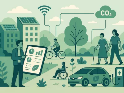
Data science
Image
Data science
The volume of information handled by companies is increasing, making their management a constant challenge. The imperative need arises to find solutions to obtain competitive advantages from the collection, analysis and transformation of data into strategic decisions.
The key advantages of Data Science are evident: accessibility, clarity, speed and customization in results.
Our specialization in Data Science allows us to analyze complex data sets and present valuable information that helps companies make objective, informed, real-time decisions.
We go beyond traditional analytics, applying advanced machine learning and artificial intelligence models to uncover hidden patterns, predict trends and optimize operations. This translates into greater operational efficiency, better customer understanding and the ability toanticipate market changes, generating a direct impact on profitability and growth.
We go beyond traditional analytics, applying advanced machine learning models and artificial intelligence to uncover hidden patterns, predict trends and optimize operations.
Image

Geographic Information System (GIS)
Image
Geographic Information System (GIS)
Geographic Information Systems (GIS)are crucial in the development and management of smart territories. At CTIC, we master their most advanced applications, including:
- GIS 3D: Creation of interactive three-dimensional maps supported by Augmented Reality (AR) and the integration of digital models of the territory.
- GIS and Data Spaces (Geo Hub): Efficient management of large volumes of geospatial data in real time, for agile decision making.
- Raster Image Analysis: Processing of raster data for comprehensive analysis of extensive terrain (land use changes, environmental impacts, etc.).
- GIS Cloud: Fostering efficient collaboration in GIS applications through the cloud, facilitating access and sharing.
- GIS & Agriculture 4.0: Specific applications for the optimization and sustainability of the agri-food sector.
The ability to visualize, analyze and manage geographic information is a strategic advantage that enables smarter urban planning, more effective natural resource management , among other actions.
Image

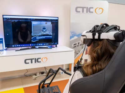
Immersive reality
Image
Immersive reality
Virtual Reality (VR), Augmented Reality (AR), Mixed Reality (MR) and the Immersive Web (WebXR) technologies are revolutionizing digital interaction. They create experiences that place the user at the center of immersive virtual worlds.
At CTIC, we design and develop innovative and customized immersive solutions. These are presented in friendly, contextual and spatial interfaces, displaying information in an intuitive and relevant way.
Our solutions range from virtual environments and 3D demonstrators to applications that allow you to explore and work in collaborative digital spaces. We facilitate communication, training and promotion in fields as diverse as engineering, tourism, marketing and education.
Our commitment to Digital Worlds opens up new opportunities to connect people, companies and knowledge in creative and accessible scenarios. These technologies break down geographic and cognitive barriers, offering new ways to learn, collaborate and experience that were previously unimaginable.
We accompany organizations in the conception, development and implementation of XR experiences that not only capture attention, but transform processes, improve training and generate tangible value for their audiences and objectives.